Maui Yacht Charter Guide: Cruising Zones, Anchorages & Local Skipper Tips

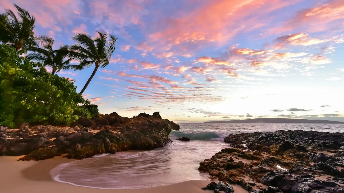
A Maui yacht charter offers an unparalleled gateway to the legendary waters of Maui Nui—a unique cruising ground comprising the islands of Maui, Molokaʻi, Lānaʻi, and Kahoʻolawe. Nestled in the heart of the Hawaiian archipelago, sailing around Maui presents an exhilarating blend of steady trade winds, dramatic volcanic backdrops, and pristine marine sanctuaries. Boating here requires active navigation, respect for wind-funneled channels, and a firm grasp of local moorage rules. For travelers seeking a high-end island escape, a private yacht charter—whether a spacious catamaran ideal for reef anchoring or a high-performance monohull built for channel crossings—is the ultimate way to access secluded snorkel spots like Molokini Crater and the turtle-rich shallows of Olowalu. Weekly bareboat charters typically range from $4,500 to $9,000, while a USCG-licensed captain adds $1,500 to $2,500 to your cruise, providing crucial regional knowledge and navigation security. If you are planning your first charter, be sure to read our guide on what to expect from a crewed yacht charter to determine the best choice for your group, or check out our adjacent Oahu yacht charter guide for neighboring island details.
Key Takeaways
- Tri-Island Versatility: The close proximity of Lānaʻi and Molokaʻi makes Maui the premier hub in Hawaii for multi-island cruising, utilizing the protected Auʻau Channel.
- Athletic Sailing Channels: Strong trade winds funneling through the Pailolo Channel create sporty, open-ocean conditions requiring experienced reefing and active weather routing.
- Reef Conservation Focus: Mooring and anchoring are highly regulated; anchoring on live coral is strictly prohibited, and day-use mooring buoys should be used wherever possible.
⚓ Maui Cruising Vitals
| Best Cruising Months | Avg. Weekly Cost | Difficulty Level | Primary Winds & Currents | License Required? |
|---|---|---|---|---|
| May–September (Summer trades) | $4,500–$9,000 (bareboat) + $1,500–$2,500 (captain) | Intermediate to Advanced | NE Trades (15–25 knots); South swells in summer, North swells in winter | Yes (DLNR approved safety cert for engines >10hp) |
Cruising Maui: The Three Primary Sailing Zones
Maui’s surrounding waters are geographically diverse, offering distinct zones that dictate your cruising comfort. Understanding the local topography is key to planning a safe and comfortable itinerary.
1. The Leeward Coast (West Maui)
Shielded by the massive West Maui Mountains, the coastline from Lahaina to Honolua Bay represents Maui’s calmest and most protected water. This lee blocks the strong northeast trade winds, creating a calm, flat sea state that is ideal for afternoon sailing, swimming, and snorkeling. Here, you will find legendary snorkeling sites like Honolua Bay and Olowalu Reef. Depths drop off quickly outside the reef lines, requiring careful depth monitoring when approaching shore. While generally forgiving, winter months can bring powerful north swells that turn normally placid bays into heavy surf zones.
2. The South Shore (Maʻalaea & Mākena)
Maʻalaea Bay is situated in Maui’s central valley, which acts as a massive natural wind funnel. As northeast trade winds squeeze between Haleakalā and the West Maui Mountains, they accelerate rapidly into the bay, frequently gusting over 30 knots even when the rest of the island is calm. Cruising here requires reefed sails and a close eye on the wind forecast. Tucked further south, Mākena offers a beautiful, scenic retreat under the lee of the Puʻu Ōlaʻi cinder cone, providing a peaceful anchorage over sandy bottoms and easy access to Molokini Crater.
3. The Tri-Island Channels
Sailing between the islands of Maui Nui requires crossing two distinct channels. The Auʻau Channel (separating Maui and Lānaʻi) is relatively shallow and sheltered, famous as a sanctuary for migrating humpback whales from December to April. It offers comfortable, flat-water cruising. In contrast, the Pailolo Channel (separating Maui and Molokaʻi) is a deep, open-ocean crossing. Tradewinds funnel through this channel at 20–25 knots, creating steep, choppy seas that challenge even experienced crews. Standard bareboat agreements often require a local captain for crossing the Pailolo due to these demanding conditions.
A 7-Day Tri-Island Yacht Charter Itinerary
This comprehensive, week-long sailing itinerary covers the best of the Maui Nui group, taking advantage of protected channels and coves for overnight stays while offering exhilarating channel sails during the day.
Disclaimer: Boating conditions, weather, and regulations change rapidly. Always cross-check with local authorities, official weather services, and paper charts before embarking.
Day 1: Maʻalaea Harbor to Olowalu Anchorage
Sailing Distance: ~10 nautical miles
Depart Maʻalaea Harbor in the early afternoon, running downwind along the scenic West Maui coastline. As you approach Olowalu, drop anchor in 15–20 feet of water over a clean sand bottom, ensuring you steer clear of the shallow coral heads. Olowalu is home to an ancient, massive reef system and a green sea turtle “cleaning station,” making it an exceptional spot for an afternoon snorkel and a calm overnight stay in the lee of the mountains.
Day 2: Olowalu to Mala Wharf / Lahaina Roads
Sailing Distance: ~6 nautical miles
Enjoy a leisurely morning sail north toward Lahaina. Anchor in the Lahaina roadstead off Mala Wharf in 20–25 feet of water over sand. Take the tender to explore the waters surrounding the collapsed concrete pier of Mala, which has transformed into an active artificial reef. You will snorkel alongside reef sharks, eagle rays, and schooling tropical fish in crystal-clear water.
Day 3: Lahaina to Honolua Bay
Sailing Distance: ~11 nautical miles
Sail north past Kaanapali Beach, watching the wind build as you clear the shadow of the mountains. Enter Honolua Bay and anchor in 25–30 feet of water over a mix of sand and flat rock. Honolua is a protected Marine Life Conservation District, boasting spectacular coral formations and massive schools of fish. This anchorage is highly secure in the summer, but completely exposed to winter’s north swells.
Day 4: Honolua Bay to Kaunakakai Harbor (Molokaʻi)
Sailing Distance: ~22 nautical miles
Prepare for a sporty, close-hauled sail across the Pailolo Channel. The channel features consistent northeast trade winds blowing 18–25 knots and a moderate beam swell. Reef your sails before departing Honolua Bay. Make landfall on Molokaʻi’s southern shore, navigating the marked reef channel into Kaunakakai Harbor. Secure a temporary berth along the recreational dock or commercial pier.
Day 5: Kaunakakai to Manele Harbor (Lānaʻi)
Sailing Distance: ~30 nautical miles
Set sail south-southwest across the Auʻau Channel, enjoying a comfortable broad reach with Lānaʻi’s massive sea cliffs on the horizon. Watch for dolphins that frequently ride the bow wave. Stand in toward Lānaʻi’s southern coast and enter Manele Harbor. This clean, state-run harbor offers excellent guest slips with electricity and water, situated adjacent to pristine snorkeling beaches.
Day 6: Manele Harbor to Mākena / Puʻu Ōlaʻi
Sailing Distance: ~20 nautical miles
Cross the Kealaikahiki Channel heading east back toward Maui. Enjoy views of Kahoʻolawe to the south. Anchor off Mākena Beach under the lee of the Puʻu Ōlaʻi cinder cone in 15–25 feet of water over soft sand. Mākena offers a beautiful, sandy anchorage with excellent swimming and paddleboarding, providing a peaceful final night on the water.
Day 7: Mākena to Molokini Crater to Maʻalaea Harbor
Sailing Distance: ~12 nautical miles
Weigh anchor at sunrise and sail to Molokini Crater before the commercial tour boats arrive. Secure your vessel to one of the public day-use mooring buoys inside the crater’s crescent caldera. Snorkel in the volcanic crater’s vertical drop-offs with over 100 feet of visibility. Conclude your charter by beating north back into Maʻalaea Harbor by early afternoon.
Ready to embark on this tri-island adventure? You can browse Maui yacht charters on WeBoating.com to find the perfect vessel and USCG-licensed captain for your Hawaiian cruise.
Maui County Small Boat Harbors & Marinas: Slips & Staging
Berthing and dockage options in Maui County are managed primarily by DLNR DOBOR, with different levels of access and facilities:
Maʻalaea Small Boat Harbor: Located on Maui’s south-central coast, this is the island’s primary operational recreational harbor. It features 89 berths, a boat ramp, loading docks, and the district DOBOR office. Depth limits are roughly 10–12 feet in the channel. Strong south/southwest winds can cause significant harbor surges.
Lahaina Small Boat Harbor: Historically the yachting capital of Maui. The harbor is undergoing active DOBOR reconstruction following the 2023 wildfires. While limited daytime commercial activities have resumed at the outer marginal wharf, transient recreational slips and overnight moorings remain unavailable. Check local notices to mariners for the latest updates.
Mala Wharf: Situated just north of Lahaina, Mala Wharf offers a double-lane boat ramp, loading docks, and offshore moorings. It serves as a vital West Maui staging point for recreational boaters and day charters.
Manele Harbor (Lānaʻi): A highly secure, well-managed state harbor on Lānaʻi’s south shore. It features recreational guest slips with water and electricity, sewage pump-out, and excellent protection from prevailing trade winds. Advanced reservations with DOBOR are mandatory.
Kaunakakai Harbor (Molokaʻi): Molokaʻi’s main harbor offers deep-water commercial berths and a small recreational boat basin. It is highly protected by a barrier reef, though entering the narrow channel requires careful alignment with the range lights.
🌪️ Weather Guardrails & Wind Systems
Sailing safely in Maui County requires a detailed understanding of the island’s unique wind patterns and seasonal changes:
- Northeast Trade Winds: Squeezing between Maui Nui’s high volcanic peaks, the trade winds (typically 15–25 knots ENE) accelerate violently in the channels. The Pailolo Channel frequently sees wind speeds 5–10 knots higher than coastal forecasts, generating steep, close-interval chop.
- Kona Winds: Occurring mainly in winter, Kona winds blow from the south or southwest. These winds replace the trades, bringing humid weather, localized rain, and lightning. Kona winds turn normally calm West Maui coves (like Honolua and Lahaina) into highly dangerous lee shores.
- Hurricane Season: The Central Pacific hurricane season runs from June 1 to November 30, peaking in August and September. While direct hits are uncommon, passing storms can bring massive swells and torrential rains, requiring flexible itinerary planning.
Local Rules, Mooring & Anchoring Regulations
Hawaii’s Department of Land and Natural Resources (DLNR) DOBOR division strictly enforces rules to protect the marine ecosystem:
– 72-Hour Anchoring Permit: You may anchor in state ocean waters for up to 72 hours without a permit, provided you anchor over sandy bottoms in designated zones and not on live coral reefs. Violators face steep fines for anchor drag damage to reefs.
– Day-Use Mooring Buoy System: To prevent reef damage, public day-use mooring buoys are placed at popular dive locations like Molokini Crater and Honolua Bay. These are free, have a 2.5-hour time limit, and prohibit overnight moorage.
– Marine Life Conservation Districts (MLCD): Anchoring is strictly prohibited within Honolua Bay and Molokini Crater MLCD boundaries. All vessels must use mooring buoys or remain under way.
Glossary: Speak Like a Maui Skipper
Mauka: Directional term meaning “toward the mountains.” In Maui, skippers use this instead of compass headings when coordinating on deck.
Makai: Directional term meaning “toward the ocean.” Used to instruct crew or orient navigation along the coast.
Kona: Southerly or southwesterly winds that blow opposite the prevailing trades, indicating stormy winter weather.
WeBoating.com is a marketplace connecting travelers with independent, third-party operators. WeBoating does not operate, manage, or own any charters or experiences.
Frequently Asked Questions About Maui Yacht Charters
The best season runs from May through September when northeast trade winds are most consistent and coves like Honolua Bay are well-protected from north swells.
Hawaii DLNR DOBOR requires a NASBLA-approved boating safety education certificate for anyone operating a motorized vessel or auxiliary-powered sailboat over 10 horsepower.
Yes, Maui is the perfect base for tri-island cruising. The Auʻau Channel to Lānaʻi is generally calm, while the Pailolo Channel to Molokaʻi offers sporty, high-wind sailing.
No, anchoring is strictly prohibited inside the Molokini Crater Marine Life Conservation District to protect the coral. Vessels must use the designated day-use mooring buoys.
Most commercial yacht charters depart from Maʻalaea Harbor on the south-central coast or use Mala Wharf just north of Lahaina for passenger staging.
The Pailolo Channel separates Maui and Molokaʻi. It is known for strong wind-funneling (18–25 knots ENE) and steep waves. While not inherently dangerous, it requires a stout vessel and an experienced crew.
You can anchor in state ocean waters for up to 72 hours without a permit. You must anchor over sand and avoid coral reefs. Stays exceeding 72 hours require a DLNR DOBOR mooring permit.
Maʻalaea Harbor offers limited transient slips. Manele Harbor on Lānaʻi offers excellent, highly secure guest slips with water and power, requiring advanced DOBOR reservations.
Kona winds are winter storms blowing from the south/southwest. They create humid conditions and turn normally protected West Maui anchorages into dangerous, wave-battered lee shores.
You can browse Maui yacht charters on WeBoating.com to compare catamarans, sailboats, and motor yachts, with or without a professional local captain.