British Columbia Yacht Charter Guide: Cruising Zones, Stern-Ties & Skipper Tips

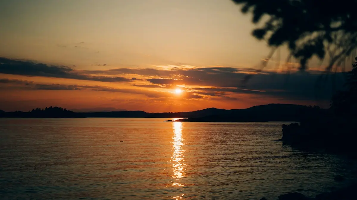
Sailing British Columbia offers an unparalleled wilderness adventure, tracing glacier-carved inlets, dramatic fjords, and pine-clad islands beneath towering volcanic peaks. The Pacific Northwest cruising grounds—ranging from the warm, sheltered bays of Desolation Sound to the technical rapids of Jervis Inlet and Princess Louisa—represent one of the most rugged and beautiful coastlines in the world. Cruising here is less about casual day-sailing and more about navigating with deep respect for the geography, tide heights, and strong tidal rapids. For travelers seeking an off-grid expedition, chartering a private vessel—whether a stable catamaran ideal for family cruising or a stout monohull built to handle coastal winds—is the ultimate way to experience this pristine coast. Weekly bareboat charters typically range from $3,500 to $8,000, while hiring a local professional skipper adds roughly $1,500 to $2,500 per week, providing essential knowledge of tidal rapids and stern-tie anchoring. If you are preparing for a yacht charter, read our guide on what to expect from a crewed yacht charter to choose the right option for your crew, or check out our adjacent Croatia yacht charter guide for a Mediterranean comparison.
Key Takeaways
- Stern-Tie Requirement: Because BC’s inlets drop straight down to hundreds of feet deep, anchoring requires backing toward shore and tieing a long line to a tree or ring on land (stern-tieing).
- Tidal Gate Timing: Navigating narrow rapids (such as Malibu Rapids or Arran Rapids) must be calculated to occur at exactly slack water to avoid dangerous whirlpools and currents.
- Thermal Inflow Winds: Coastal fjords funnel afternoon thermal winds (inflows) up to 20–30 knots, requiring reefed sails and strategic route timing.
⚓ British Columbia Cruising Vitals
| Best Cruising Months | Avg. Weekly Cost | Difficulty Level | Primary Winds & Currents | License Required? |
|---|---|---|---|---|
| June–September (Warmest water) | $3,500–$8,000 (bareboat) + $1,500–$2,500 (captain) | Intermediate to Advanced | Thermal inflows (10-25 kts); tidal rapids currents up to 10-15 kts | No (Sailing Resume checked by charter operator; PCOC recommended) |
Cruising British Columbia: The Three Primary Sailing Zones
BC’s vast inner passage is split into three distinct cruising zones, each offering a completely different climate, topography, and navigation difficulty.
1. Desolation Sound (Warm-Water Cruising)
Desolation Sound is BC’s premier charter destination, situated at the northern end of the Strait of Georgia. It is famous for having surprisingly warm summer waters (exceeding 20°C / 68°F) due to minimal tidal exchange, making it excellent for swimming and paddleboarding. Surrounded by snow-capped peaks rising 6,000 feet straight out of the water, it offers iconic anchorages like Prideaux Haven and Tenedos Bay. The waters are sheltered from open-ocean swells, providing calm passages and stunning, green mountain views.
2. Jervis Inlet & Princess Louisa (Glacial Fjords)
For a deep-wilderness experience, Jervis Inlet winds inland between sheer granite walls. This fjord leads to the legendary Princess Louisa Inlet, widely regarded as one of the natural wonders of the world. Accessing Princess Louisa requires navigating Malibu Rapids—a narrow, curving choke point where tidal currents can surge at 9 knots, creating standing waves and whirlpools. Entering here must be timed at exactly slack water. Once inside, you sail into a tranquil basin surrounded by granite walls and dominated by Chatterbox Falls tumbling into the sea.
3. Johnstone Strait & Discovery Islands (Technical Rapids)
Johnstone Strait separates Vancouver Island from the mainland, serving as a deep-water channel famous for its resident pod of Orcas (killer whales). This zone features strong currents, heavy winds, and highly technical navigation. The Discovery Islands (like Quadra, Cortes, and Sonora) are separated by narrow passages where the tide rushes through at speeds exceeding 12 knots. Navigating these rapids requires a high-authority engine, precise chart calculations, and local pilotage experience.
A 7-Day Desolation Sound Yacht Charter Itinerary
This classic week-long itinerary is designed as a loop starting from Lund or Powell River, taking advantage of short daily legs to maximize hiking, warm-water swimming, and stern-tie anchoring practice.
Disclaimer: Boating conditions, weather, and regulations change rapidly. Always cross-check with local authorities, official weather services, and paper charts before embarking.
Day 1: Lund to Copland Islands Marine Park
Sailing Distance: ~5 nautical miles
Depart Lund Harbour in the early afternoon. Cross the Thulin Passage to the Copland Islands Marine Park. Anchor in the sheltered, narrow channel between the islands in 25–30 feet of water over sand and mud. The Coplands are a cluster of low-lying, rocky islets ideal for kayaking and exploring tidal pools, providing a quiet first night on the water.
Day 2: Copland Islands to Tenedos Bay
Sailing Distance: ~10 nautical miles
Sail north past the Malaspina Peninsula into Desolation Sound proper. Slide into Tenedos Bay and execute your first stern-tie anchorage: drop anchor in 30 feet of water over mud, back up toward the shore, and tie a long floating line to a designated metal ring on the rock or a sturdy tree. Hike ashore to Unwin Lake, a warm freshwater lake nestled in the forest, for a swim.
Day 3: Tenedos Bay to Prideaux Haven
Sailing Distance: ~8 nautical miles
Take a short morning cruise past Sarah Point to Prideaux Haven, BC’s most famous anchorage. This highly protected basin is surrounded by dramatic granite peaks and features incredibly warm water. Navigate slowly through the shallow reef entrance and secure a stern-tie in 20 feet of water. Spend the afternoon paddleboarding around the islets and enjoying the warm water.
Day 4: Prideaux Haven to Refuge Cove
Sailing Distance: ~12 nautical miles
Weigh anchor and cruise past Homfray Channel to Refuge Cove on West Redonda Island. Refuge Cove is an active boardwalk co-op community serving as the central provisioning hub of the sound. Dock along the wooden quays to buy fresh water, groceries, locally baked goods, and dispose of garbage. Reprovision and moor overnight along the docks, or anchor in the outer cove.
Day 5: Refuge Cove to Gorge Harbour (Cortes Island)
Sailing Distance: ~15 nautical miles
Sail west across the Waddington Channel toward Cortes Island. Enter Gorge Harbour through the “Gorge”—a spectacular, narrow channel flanked by sheer rock cliffs. Once inside, the harbor opens into a spacious, flat-water basin. Tie up at Gorge Harbour Marina to enjoy full-service slips, electricity, fresh water, hot showers, a heated swimming pool, and an onsite restaurant.
Day 6: Gorge Harbour to Grace Harbour
Sailing Distance: ~12 nautical miles
Exit the Gorge and sail northeast into Gifford Peninsula. Slide into Grace Harbour, a deeply indented, heavily forested cove that is completely sheltered from all winds. Drop anchor in 30 feet over sticky mud and run a stern line to the shore. Hike the land trails leading through the moss-draped Douglas fir forests to a secluded saltwater lagoon.
Day 7: Grace Harbour to Lund Harbour
Sailing Distance: ~14 nautical miles
Weigh anchor and sail down the Malaspina Strait. Catch the summer afternoon inflows to enjoy a spirited run back toward the Malaspina Peninsula. Keep an eye out for harbor seals and bald eagles along the rocky points. Conclude your charter at Lund Harbour or return to Powell River for check-out.
Interested in exploring these inlets? You can browse yacht charters on WeBoating.com to compare sailing vessels and hire a local professional captain for your BC cruise.
BC Marine Infrastructure: Harbors & Marinas
Staging and docking in British Columbia are characterized by small, rustic marinas, historic boardwalk co-ops, and local harbor authorities:
Lund Harbour: Managed by the Harbour Authority of Lund, this is the main gateway to Desolation Sound. It offers concrete docks, fresh water, shore power, fuel (gas/diesel), and groceries. Slips are heavily booked during summer, so reserve early.
Refuge Cove: A historic, co-op-owned boardwalk marina on West Redonda Island. It is the vital supply station for Desolation Sound, providing fuel, propane, fresh water, garbage disposal, a general store, and local art galleries.
Gorge Harbour Marina (Cortes Island): A full-service, resort-style marina offering premium concrete slips, shore power, fresh water, a laundry station, fuel, a general store, and a heated swimming pool.
Powell River (Westview Marina): A large, deep-water port on the Sunshine Coast, offering full commercial services, fuel, marine mechanics, and extensive provisioning supermarkets within walking distance.
🌪️ Weather Guardrails & Coastal Hazards
Sailing safely in the Pacific Northwest requires a detailed understanding of local weather and water temperature dynamics:
- Inflow/Outflow Winds: Coastal inlets act as natural wind tunnels. During warm summer days, hot air rising in the interior valleys pulls cool marine air inland, creating strong afternoon “inflow” winds of 15–25 knots ESE. Conversely, winter or early morning “outflow” winds blow cold air from the mountains down the inlets.
- Summer Fog: Warm summer air meeting the cold waters of the Strait of Georgia frequently generates thick fog banks, reducing visibility to zero. Skippers must have functional radar, GPS, and AIS, and remain comfortable navigating blind.
- Cold Water Shock: While the surface water of shallow Desolation Sound coves can reach 20°C, the open passages (like Malaspina Strait or Johnstone Strait) remain between 8–12°C (46–54°F) year-round. Falling overboard carries a severe risk of hypothermia; skippers must wear PFDs on deck.
Local Rules, Stern-Ties & Rapids Regulations
Navigating British Columbia requires specific seamanship techniques and compliance with local environmental laws:
– Mandatory Stern-Tie Anchoring: In deep inlets, the seabed drops from 10 feet to 100 feet within a short distance of the shore. Traditional anchoring is impossible because a boat would swing onto the rocks when the wind shifts. To secure the boat, drop anchor in 30-40 feet, back toward shore, and run a long floating line from the stern to a tree or metal ring on the rock face, tieing it off to keep the bow facing out.
– Tidal Rapids and Slack Water: Passages like Malibu Rapids or Arran Rapids have currents up to 9-12 knots. Sailing through during peak flow is extremely dangerous and can cause capsizing or loss of steerage. Skippers must consult local tide tables and navigate these rapids only within 10–15 minutes of “slack water” (when the tide stops running).
– Marine Parks & Wildlife: Desolation Sound and Jervis Inlet contain many marine parks. Anchoring is free, but you must respect marine conservation zones. Federal regulations mandate staying at least 400 meters away from killer whales (orcas).
Glossary: Speak Like a BC Skipper
Stern-Tie: Tying the stern of the boat to a shoreline tree or rock ring while the bow is held by a standard anchor, preventing the boat from swinging in narrow bays.
Slack Water: The brief period when a reversing tidal current turns and has zero velocity, which is the only safe window to navigate BC’s tidal rapids.
Glacial Flour: Fine silt suspended in the water, washed down from glaciers, which scatters light and gives BC’s inlets their vibrant, turquoise color.
WeBoating.com is a marketplace connecting travelers with independent, third-party operators. WeBoating does not operate, manage, or own any charters or experiences.
Frequently Asked Questions About Sailing in British Columbia
The best sailing season runs from June through September. July and August offer the warmest temperatures, least rainfall, and consistent afternoon thermal inflow winds.
Stern-tieing involves dropping an anchor from the bow and running a line from the stern to a tree or metal ring on shore. It is necessary because BC’s coves are deep and narrow, preventing boats from swinging freely without hitting rocks.
Consult local tide tables and calculate the exact time of slack water. Enter the rapids only within a 10-15 minute window of slack water, keeping a high-authority engine running for safety.
No formal government license is required for bareboat charters in BC. Renter captains must submit a detailed sailing resume showing experience with vessels of similar size and displacement.
Yes. Desolation Sound’s shallow coves experience very little tidal exchange, allowing the surface water to warm up to 20°C–22°C (68°F–72°F) in July and August.
Inflow winds are daytime thermal breezes blowing from the sea inland (15-25 kts ESE). Outflow winds are cold early morning breezes blowing from the inland glaciers down the inlets.
Lund Harbour at the entrance offers full fuel and water services. Inside the sound, Refuge Cove boardwalk marina offers fuel, fresh water, groceries, and garbage disposal.
Open passages remain cold year-round, between 8°C–12°C (46°F–54°F). Wearing PFDs is critical as falling overboard carries an immediate risk of cold water shock.
Canadian federal law strictly mandates that all vessels must maintain a minimum distance of 400 meters from killer whales in southern BC coastal waters.
You can browse yacht charters on WeBoating.com to compare monohulls, catamarans, and trawlers, with or without a professional local captain.