To read tides and currents for safer boating, start by consulting official tide tables and current predictions for the exact station or pass you plan to transit. Identify the next slack water—the brief, calm window when tidal currents reverse direction between flood and ebb—and plan your departure or arrival around this window. Cross-check your calculations with the marine weather forecast, as opposing winds can steepen waves, creating a dangerous chop. On your charts or navigation apps, trace how physical constrictions like narrows, bridges, or headlands accelerate water flow, and identify waiting spots or alternate routes if current speeds exceed your boat’s cruising speed. Finally, verify these forces visually on the water by observing kelp angles, buoy wakes, and rip lines, and adjust your heading to compensate. When in doubt, delay your transit for slack water, hug back-eddies near the shoreline, and keep enough engine power in reserve to maintain steerage. This simple method—predict, confirm, and adjust—turns tides and currents from a hazard into a powerful ally. For regional cruising, check out our adjacent British Columbia yacht charter guide for navigation strategies, or read our Gulf Islands yacht charter guide for a scenic look at high-current Pacific Northwest waters.
Key Takeaways
- Tides vs. Currents: Tides represent the vertical rise and fall of water levels, while currents are the horizontal movement of water masses, measured in knots.
- Slack Water Windows: Navigating narrow tidal channels or docking in tight slips must be timed during “slack water,” when horizontal current velocity drops to zero.
- Safety Standoff: When wind blows opposite to the direction of the tidal current (wind-against-tide), it generates steep, short-period waves that can swamp small vessels.
⚓ Navigation & Current Vitals
| System / Hardware Class | Primary Brands / Sources | Technical Difficulty | Safety Criticality | Typical Cost Range |
|---|---|---|---|---|
| Tidal & Current Prediction Tools | NOAA, Navionics, CHS, UKHO, paper current atlases | Intermediate (Requires chart reading) | High (Critical for narrows & bars) | $0–$60 (Free apps to paper charts) |
Tides vs. Currents: Understanding the Physics
To navigate safely, you must distinguish between the vertical and horizontal movements of the sea. They are related but distinct forces that affect your vessel in different ways.
1. Vertical Change: Tides
Tides are the vertical rise and fall of the ocean’s surface, driven primarily by the gravitational pull of the moon and the sun, combined with the rotation of the Earth. When the sun and moon align (during a new or full moon), their combined gravity creates extreme high and low tides, known as Spring Tides. When they are at right angles (during a quarter moon), the tidal range is minimized, resulting in Neap Tides. Depending on your location, you may experience Semidiurnal Tides (two equal highs and lows daily, common in New England), Diurnal Tides (one high and one low daily, common in parts of the Gulf of Mexico), or Mixed Semidiurnal Tides (two unequal highs and lows daily, typical in the Pacific Northwest).
2. Horizontal Change: Currents
Current is the horizontal movement of water. In tidal regions, this is called tidal current. When the tide rises, water flows inland; this is the flood current. When the tide falls, water flows back to the sea; this is the ebb current. The speed of the current is measured in knots, and its direction is called the set (expressed in degrees or compass direction), while the speed is called the drift. For example, a current setting 180 degrees at 2 knots is moving due south.
Where to Get Reliable Tide and Current Predictions
Never rely on a single source or guesswork for navigation. Cross-check your plans using these reliable tools:
NOAA Tides & Currents: For U.S. waters, the National Oceanic and Atmospheric Administration (NOAA) offers the gold standard of real-time measurements and astronomical predictions. Their web portal provides tables for thousands of reference and subordinate stations, showing exact times for high/low tides, maximum floods/ebbs, and slack water.
Chartplotter Overlays & Apps: Modern chartplotters and mobile apps (like Navionics, iNavX, or Aqua Map) display current prediction arrows directly on electronic vector charts. These arrows change size and color based on current speed and direction, making it easy to visualize the flow. However, always verify that your app’s offline data is updated, as out-of-date databases can introduce dangerous timing errors.
Paper Current Atlases: For highly technical regions like the San Juan Islands or the Discovery Islands, paper current atlases (such as the Canadian Hydrographic Service or local yachting current guides) display page-by-page diagrams of every hour of the tide cycle. These show local back-eddies, rip lines, and whirlpools that digital apps often smooth over.
Practical Reading: From Table to Transit
Reading a tide table is straightforward: look up your date and location, locate the high and low tide heights, and note the times. To estimate the rate of water level change between high and low tide, skippers traditionally use the Rule of Twelfths. This rule assumes the tide rises or falls over a 6-hour period as follows:
- 1st Hour: 1/12 of the total range
- 2nd Hour: 2/12 of the total range
- 3rd Hour: 3/12 of the total range (Peak flow begins)
- 4th Hour: 3/12 of the total range (Peak flow continues)
- 5th Hour: 2/12 of the total range
- 6th Hour: 1/12 of the total range
Note: While useful for quick estimations, the Rule of Twelfths is a mathematical abstraction. It assumes a symmetrical, 6-hour tide cycle. In areas with mixed semidiurnal tides (like Puget Sound) or narrow constrictions, the cycle is often asymmetrical, and actual currents can peak much earlier or later. Always prioritize official current prediction tables over the Rule of Twelfths.
Reading the Water: Field Cues You Can Trust
Electronic instruments are invaluable, but a skilled skipper always cross-checks using visual cues on the water’s surface:
Kelp Angles & Buoy Wakes: Kelp fronds floating at the surface act as natural current indicators, streaming like arrows in the direction of the flow. Similarly, watch the wakes generated by stationary objects like mooring balls, bridge pilings, or anchored vessels. A strong wake streaming behind a buoy indicates high current, and the angle of the lean tells you its direction.
Rip Lines & Overfalls: A rip line appears as a distinct line of foam, debris, or glassy water where two opposing currents meet. Overfalls (standing waves) occur when a fast-moving current flows over a shallow bar or rocky ledge, or when it meets an opposing wind. Boils and swirls indicate turbulent water rising from a rough seabed below.
Helm Feedback: As you cross a current shear line (the boundary between fast water and a slow eddy), you will feel a sudden change in wheel pressure as the water grabs your rudder. Keep a firm grip on the helm and be prepared to apply counter-rudder to maintain your course.
Local Skipper Playbook: Pacific Northwest & British Columbia Case Studies
The waters of the Pacific Northwest and British Columbia are famous for their mixed semidiurnal tides, massive tidal ranges, and dramatic constrictions, making this region a masterclass in current navigation:
Case Study 1: Timing Tacoma Narrows (Washington)
Tacoma Narrows is a deep, narrow channel where the main body of Puget Sound constricts, creating currents that regularly reach 3 to 5 knots. Riding a favorable flood current south can shave an hour off your trip and conserve fuel, but entering during peak ebb against a strong southerly wind generates steep, punishing standing waves. Schedule your transit to enter the Narrows just as the flood starts, or close to slack water.
Case Study 2: Deception Pass (Washington)
Deception Pass separates Fidalgo Island from Whidbey Island, serving as a narrow, rocky throat where currents can surge at an incredible 6 to 8 knots during spring tides. Navigating here during peak flow is extremely dangerous, producing massive whirlpools and boiling overfalls. Low-powered powerboats and sailboats must wait at nearby anchorages (like Bowman Bay or Cornet Bay) and transit only within a 10-15 minute window of true slack water.
Case Study 3: Dodd Narrows (Gulf Islands, BC)
Dodd Narrows constricts tidal waters between Vancouver Island and Mudge Island. This narrow corridor sees heavy recreational traffic, yet water flow regularly reaches 9 knots, producing violent back-eddies and vortices.
Case Study 4: Active Pass (Gulf Islands, BC)
Active Pass, separating Galiano and Mayne Islands, is the primary channel for commercial BC Ferries. The current flows at 4 to 8 knots here, causing ferry hulls to steer at severe angles. Recreational boaters must yield right-of-way, maintain active watch, and time their transits strictly to minimize current resistance and ferry encounters.
Case Study 5: Skookumchuck Narrows (Sechelt Peninsula, BC)
Famous worldwide for its spectacular rapids, Skookumchuck Narrows connects Sechelt Inlet with the Pacific Ocean. As the tide shifts, billions of gallons of water surge through a narrow neck, creating currents that reach an astonishing 16 knots (30 km/h). This massive rush generates standing waves up to 6 feet tall, roaring overfalls, and whirlpools deep enough to pull small boats under. Transiting in anything other than a high-powered, highly maneuverable vessel exactly at slack water is highly dangerous.
Case Study 6: Devil’s Hole / Dent Rapids (Discovery Islands, BC)
Dent Rapids separates Dent and Sonora Islands in the Discovery passage network. During spring tides, currents surge up to 15 knots. This flow interacts with the uneven volcanic seabed to create “Devil’s Hole,” a massive, bubbling whirlpool that changes position dynamically. The vortex is strong enough to spin commercial tugboats out of control and swamp recreational craft. Skippers must check Canadian Hydrographic Service tables and transit strictly within the slack water gate.
Case Study 7: Tofino Tidal Traps (West Coast of Vancouver Island)
Tofino experiences a massive tidal range of up to 4 meters (13 feet). During an incoming flood tide, wide sandy beaches (such as at Chesterman Beach or Cox Bay) can completely disappear underwater in a matter of minutes. The rapid water rise turns rocky outcrops into isolated, wave-swept islands and traps hikers against steep, vertical coastal cliffs. Hikers, beachcombers, and paddlers must consult local tide charts before walking on the tidal flats or exploring tidal caves.
Seamanship and Boat Handling in Strong Currents
Operating a vessel in current requires adjusting your docking, anchoring, and motoring strategies:
– Docking in a Crosscurrent: Always approach the dock facing into the current. This gives you maximum steerage and control at slow speeds. Use a technique called “ferry-gliding”: angle your bow slightly away from the dock and let the current push you laterally toward the slip, using gentle forward throttle to control your approach. Have your spring line ready to secure first.
– Hugging Shoreline Eddies: When motoring against a strong head current in a channel, look for “back-eddies” that form close to the shoreline behind points of land. The current in these eddies often flows in the opposite direction of the main channel, providing a free push. However, watch your depth sounder closely, as these eddies form near shallow margins.
– Anchoring for Current Swings: When anchoring in tidal waters, remember that your boat will swing 180 degrees when the current reverses. Ensure you have ample swinging room from other vessels and shallow reefs. Use a scope of at least 5:1 (preferably 7:1) of rode to depth, and set a secondary anchor or a stern-tether if anchoring in tight, high-current coves.
🛠️ The Navigation Gear Locker: Essential Tools
Rig your helm with these essential tools to predict and monitor tides and currents:
| Tool Name | Technical Specifications | Skipper Purpose |
|---|---|---|
| NOAA Tides & Currents App | U.S. government data, offline access | Provides astronomical tide and current tables for key reference stations. |
| Vector Chartplotter | GPS-integrated, electronic current overlays | Visualizes current speed and direction vectors directly on your digital charts. |
| Paper Current Atlas | Page-by-page hourly current maps | Displays local back-eddies, rips, and shears not captured by electronic apps. |
| Polarized Sunglasses | UV protection, glare-cutting lenses | Critical: Cuts surface water reflection so you can see boils, rips, and shoals. |
| 7×50 Marine Binoculars | Scale reticle, compass overlay | Allows you to read range markers, buoy leans, and kelp angles from a distance. |
| Depth Sounder | Transducer, real-time alarms | Monitors changing water depth beneath your keel as the tide rises and falls. |
📊 Tidal Pass Navigation Readiness Scorecard
Before transiting a high-current constriction or tidal rapids, evaluate your vessel’s readiness out of 10 points. If your score is below 7, delay your transit until conditions improve:
| Readiness Metric | Evaluation Criteria | Score (1-2 pts) |
|---|---|---|
| Vessel Power | Vessel has sufficient engine horsepower to exceed the maximum predicted current speed by at least 3 knots (2 pts). | / 2 |
| Slack Calculation | Exact time of slack water has been cross-checked across two independent sources (e.g. NOAA and Navionics) (2 pts). | / 2 |
| Local Charts | Up-to-date vector charts and paper current atlas are open at the helm station (2 pts). | / 2 |
| Weather Window | Forecast wind is in the same direction as the current (wind-with-tide) or wind is under 10 knots (2 pts). | / 2 |
| Crew Gear | Crew is wearing PFDs, VHF radio is tuned to Channel 16, and anchor is rigged and ready for emergency drop (2 pts). | / 2 |
Troubleshooting: Handling Current Emergencies
If you make a calculation error or experience mechanical failure in a high-current zone, execute these safety-first steps immediately:
1. Caught in a Strong Rip: If your vessel is grabbed by a strong tide rip or whirlpool, do not fight it head-on. Steer at a 45-degree angle toward the edge of the rip line to escape the main current flow. Keep your engine revved to maintain steerage; cutting power will cause you to lose rudder control.
2. Dragging Anchor in Current: If your anchor drags when the current swings, immediately fire up your engine and put it in gear to relieve strain on the anchor rode. Let out more scope (aim for 7:1 or 8:1) to help the anchor re-bite. If the seabed is rocky or weedy, pull the anchor and relocate to a sandy flat.
3. Missing the Slack Water Gate: If you arrive late at a narrow pass and the current has already built past your boat’s motoring capability, do not attempt to force it. Turn around, find a sheltered cove or mooring nearby, drop anchor, and wait 6 hours for the next slack water window.
Glossary: Speak Like a Navigator
Slack Water: The brief period when a reversing tidal current has zero horizontal velocity before switching direction between flood and ebb.
Set and Drift: The direction (set) and speed (drift) of a current. Set is expressed in degrees true, and drift is measured in knots.
Overfalls: Turbulent standing waves created when a fast-moving current passes over a shallow underwater ledge or reef, or meets an opposing wind.
WeBoating.com is a marketplace connecting travelers with independent, third-party operators. WeBoating does not operate, manage, or own any charters or experiences.
Frequently Asked Questions About Tides and Currents
Consult official current tables (such as NOAA Current Predictions or Canadian Hydrographic Service tables). Slack water times are listed explicitly alongside the maximum flood and ebb current times and speeds.
Tides are the vertical rise and fall of water levels, while currents are the horizontal movement of water masses. Tides affect depth and draft, while currents affect boat speed and steering.
Wind-against-tide conditions generate steep, short-period waves that can crash over the bow of small boats. Always cross-check forecasts and avoid transiting inlets or narrows in strong opposing winds.
Always turn your bow into the current to approach the dock. Use a ferry-glide angle to let the current push you sideways, using gentle forward throttle to control the rate of approach.
No. The Rule of Twelfths is only an approximation for the rise and fall of the tide level, not current speed. Current velocities change based on shoreline constrictions and underwater channels.
Spring tides occur during new and full moons when the sun and moon align, creating the highest high tides and lowest low tides. Neap tides occur during quarter moons, resulting in the smallest tidal range.
Motoring against a 3-knot current reduces your speed over ground (SOG). To maintain schedule, you must run at higher RPMs, which dramatically increases fuel burn. Riding a favorable current has the opposite effect.
Due to the Venturi effect, when a large volume of water is forced through a narrow channel or constriction (like a pass, gorge, or under a bridge), its velocity must increase to move the same volume.
A rip line appears as a distinct line of foam, floating debris, or a contrast between glassy and choppy water where two opposing currents or sea states meet.
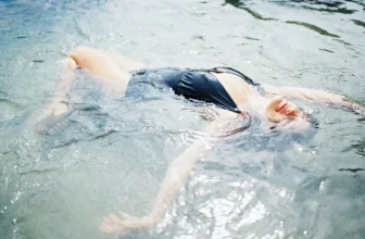
The rule states that an unprotected person has a 50% chance of survival in 50°F (10°C) water for 50 minutes. Always wear a wetsuit or drysuit when water temperatures drop below 60°F (15.5°C).
You can browse yacht charters on WeBoating.com to find boats, compare vessels, and hire a local captain who knows the tides, current gates, and safe anchorage spots.
Absolutely not. Running these constrictions at peak flow exposes your vessel to currents up to 16 knots, whirlpools, and standing waves. Transit should only be attempted during the brief window of slack water.