Exumas Yacht Charter Guide: Staniel Cay Cruising Itinerary & Skipper Tips

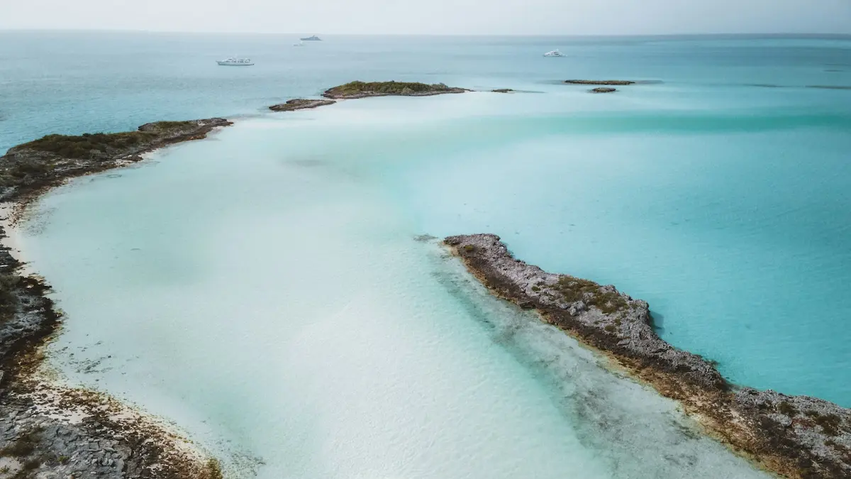
An Exumas yacht charter offers one of the world’s most spectacular shallow-water cruising experiences, spanning a 120-mile crescent of low-lying cays, sapphire waters, and pristine sandbars. The best time to sail the Exumas is from November through April when trade winds are stable and temperatures average 75°F to 80°F, while bareboat catamaran charters typically range from $6,000 to $15,000 per week, and no formal sailing license is legally required if you submit a verified boating resume. Because of the extensive shallow sand flats, choosing a shallow-draft catamaran is highly recommended over a deep-draft monohull. If you are comparing tropical cruising regions, view our adjacent BVI yacht charter guide or our Bahamas yacht charter guide to find your perfect island-hopping itinerary.
Key Takeaways
- Shallow-Draft Catamarans: Navigating the shifting sandbanks of the Exuma Bank requires vessels drawing under 4 feet to slip into protected anchorages.
- Tidal Current Gates: Cruising through the “cuts” between the deep Exuma Sound and the shallow Exuma Bank requires precise timing to avoid dangerous standing waves.
- Pristine National Parks: The Exuma Cays Land and Sea Park is a strictly enforced no-take zone with specific mooring and anchoring rules.
⚓ Quick Facts & Experience Vitals
| Best Time to Go | Avg. Weekly Cost | Difficulty Level | Key Winds / Currents | License Required? | Primary Embarkation Port |
|---|---|---|---|---|---|
| November–April (Dry season, warm) | $6,000–$15,000 (bareboat) + $1,500–$2,500 (skipper) | Intermediate (Shallow water piloting & tidal cuts) | NE/E trade winds (15-20 kts); strong currents in cuts | No (Sailing resume required for bareboat) | Nassau (Palm Cay Marina) / Staniel Cay |
The Lay of the Land (Introduction)
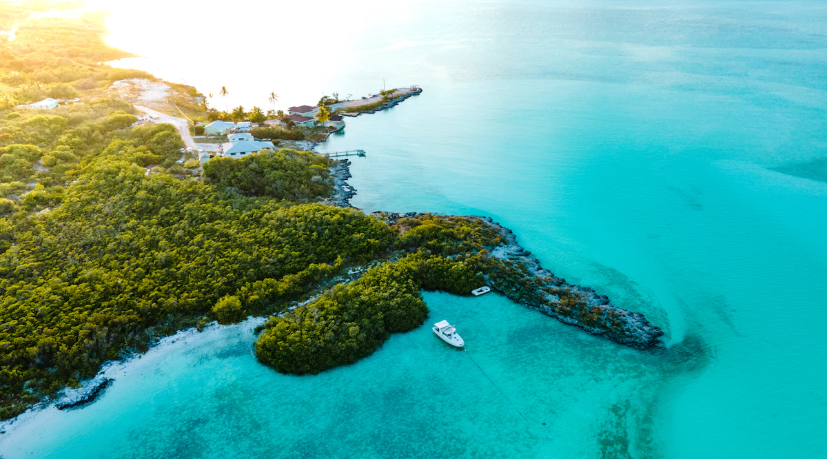
Cruising the Exumas is a journey through a world of dazzling water colors. As you sail over the shallow Great Bahama Bank, the water under your hull changes from a milky jade green to a brilliant, transparent turquoise that makes the catamaran look like it is floating in mid-air. In the early morning, the smell of wild sage and salt spray drifts off the low-lying limestone cays, mixed with the warm scent of sun-baked sand. The windward side of the cays faces the deep indigo water of the Exuma Sound, where steep cliffs drop into the sea, while the leeward side features endless miles of empty white sand beaches and sheltered anchorages. From the northern outpost of Allen’s Cay down to the bustling cruising hub of Great Exuma, the chain is a playground for sailors seeking marine wildlife, historic plane wrecks, and secluded island outposts.
Sailing Zones / Cruising Sectors
The Exuma chain is geographically divided into three primary cruising sectors, each offering a distinct sea state, wind exposure, and piloting requirement:
1. The Northern Cays: Allen’s Cay to Norman’s Cay
This sector is the primary gateway for charters departing from Nassau. It features the famous Northern Bahamian Rock Iguanas at Allen’s Cay and the historic drug-smuggling hub of Norman’s Cay. Navigating here involves crossing the Yellow Bank, a wide sand flat dotted with dark coral heads that require good overhead sunlight to pilot around visually. Anchorages are relatively open but provide decent shelter from easterly winds.
2. The Central Park Zone: Shroud Cay to Warderick Wells
The heart of the Exuma Cays Land and Sea Park, this sector is a highly protected marine sanctuary. It features pristine mangrove rivers, hiking paths up to Boo Boo Hill, and narrow, deep-water mooring fields. The sea state on the bank side is calm and shallow, but crossing through the tidal cuts to the Exuma Sound side requires careful navigation, as strong currents run perpendicular to the island chain.
3. The Southern Cays: Staniel Cay to Great Exuma
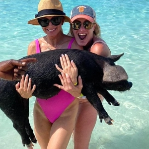
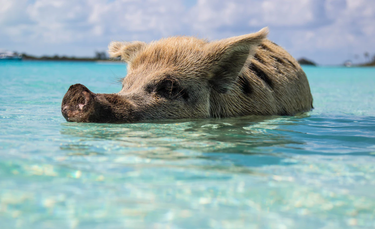
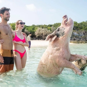
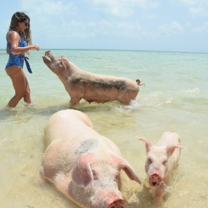
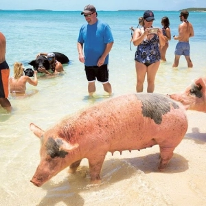
This sector is the commercial and social hub of the outer islands, centered around Staniel Cay. It features iconic highlights like the swimming pigs at Big Major Spot, the nurse sharks at Compass Cay, and the underwater cave at Thunderball Grotto. Further south, the cruising ground opens up toward Great Exuma and Elizabeth Harbour in Georgetown, offering larger sailing distances and deeper, more open water.
Sailing Itineraries
Itinerary 1: The Northern & Central Exumas Explorer (Nassau Round-Trip, 7 Days)
This classic one-week loop departs from Palm Cay Marina in Nassau and covers the pristine northern cays and the protected national park before returning north.
Day 1: Nassau (Palm Cay Marina) to Allen’s Cay
Sailing Distance: ~28 nautical milesRouting Details: Cast off and sail southeast across the shallow Great Bahama Bank; navigate carefully through the dark patches of the Yellow Bank.
Anchoring & Staging: Drop anchor in the narrow channel between Leaf Cay and Allen’s Cay in 10 feet of sand; holding is excellent.
Marine Highlights: Go ashore on Leaf Cay to see the endemic, prehistoric Northern Bahamian Rock Iguanas that come down to the beach.
Day 2: Allen’s Cay to Norman’s Cay
Sailing Distance: ~12 nautical milesRouting Details: Easy south-southeast sail down the bank; watch for shallow sand spits running west off the islands.
Anchoring & Staging: Anchor in the southern bay of Norman’s Cay in 8 feet of sand, or dock at the Norman’s Cay Marina.
Marine Highlights: Snorkel the famous sunken Curtiss C-46 drug-smuggling plane wreck in the shallow water of the southern spit.
Day 3: Norman’s Cay to Shroud Cay
Sailing Distance: ~8 nautical milesRouting Details: Short coastal transit south, entering the northern boundary of the Exuma Cays Land and Sea Park.
Anchoring & Staging: Anchor off the western beach of Shroud Cay in 12 feet of clear sand; watch for tidal current swing.
Marine Highlights: Take the dinghy through the winding mangrove creeks to the eastern side of the island to visit “Camp Drift.”
Day 4: Shroud Cay to Warderick Wells
Sailing Distance: ~15 nautical milesRouting Details: Sail south along the bank side; approach the park headquarters via the narrow, deep-water northern channel.
Anchoring & Staging: Pick up a pre-booked park mooring ball in the horseshoe-shaped main channel; anchoring is restricted.
Marine Highlights: Hike the trails up to Boo Boo Hill to leave a drift-wood offering, and view the massive skeleton of a sperm whale.
Day 5: Warderick Wells to Staniel Cay
Sailing Distance: ~18 nautical milesRouting Details: Sail south past Compass Cay and Sampson Cay, keeping a close eye on the depth over the shallow banks.
Anchoring & Staging: Anchor off Big Major Spot in 10 feet of sand, or dock at the Staniel Cay Yacht Club.
Marine Highlights: Feed the famous swimming pigs at Big Major Spot, and snorkel the limestone cave of Thunderball Grotto.
Day 6: Staniel Cay to Highborne Cay
Sailing Distance: ~30 nautical milesRouting Details: Head north on a long, sporty sail along the bank side, or transit through a cut to sail the deeper Exuma Sound.
Anchoring & Staging: Secure a transient slip at Highborne Cay Marina, or anchor off the western beach in 12 feet of sand.
Marine Highlights: Rent a golf cart to explore Highborne’s beaches, and watch the nurse sharks feed at the marina docks.
Day 7: Highborne Cay back to Nassau (Palm Cay Marina)
Sailing Distance: ~35 nautical milesRouting Details: Sail northwest across the open water of the bank back to Nassau, keeping a sharp lookout for Yellow Bank coral heads.
Anchoring & Staging: Return to Palm Cay Marina, complete vessel check-out and clear the charter dock.
Marine Highlights: Celebrate the end of your cruise with a dinner at the Palm Cay beach club restaurant.
Itinerary 2: The Southern Cays Catamaran Cruise (Staniel Cay Round-Trip, 7 Days)
This itinerary starts directly from the heart of the Exumas at Staniel Cay, exploring the wilder and less-visited southern cays and anchorages.
Day 1: Staniel Cay to Big Major Spot
Sailing Distance: ~2 nautical milesRouting Details: Short shake-down hop north from the Staniel Cay runway docks to the neighboring bay.
Anchoring & Staging: Drop anchor in the wide sandy bay of Big Major Spot in 10 feet of sand; very sheltered from easterly winds.
Marine Highlights: Swim with the pigs in the late afternoon after the day-trip tour boats from Nassau have departed.
Day 2: Big Major Spot to Compass Cay
Sailing Distance: ~8 nautical milesRouting Details: Sail north along the bank, avoiding the shallow sand bars around Sampson Cay.
Anchoring & Staging: Tie up at the rustic wood docks of Compass Cay Marina, or anchor outside in the shallow channel.
Marine Highlights: Swim and wade with the friendly pet nurse sharks that gather on the submerged dock platform.
Day 3: Compass Cay to Little Farmers Cay
Sailing Distance: ~14 nautical milesRouting Details: Sail south past Staniel Cay and Bitter Guana Cay, heading down into the quiet southern sector.
Anchoring & Staging: Anchor in the sand flats off Little Farmers Cay in 8 feet of sand, or moor near Farmers Cay Yacht Club.
Marine Highlights: Snorkel the cave at Bitter Guana Cay to see the iguanas, and swim with the green sea turtles at the Farmers Cay dock.
Day 4: Little Farmers Cay to Cave Cay
Sailing Distance: ~10 nautical milesRouting Details: Continue sailing south along the bank side; watch the shifting sand dunes around Darby Island.
Anchoring & Staging: Enter the highly sheltered, deep basin of Cave Cay Marina or anchor inside the harbor.
Marine Highlights: Explore the sea caves of Cave Cay, and walk the deserted white sand beaches on the eastern coast.
Day 5: Cave Cay to Lee Stocking Island
Sailing Distance: ~18 nautical milesRouting Details: Sail south along the island chain, crossing through one of the southern cuts if heading to the sound side.
Anchoring & Staging: Drop anchor in the deep channel off the abandoned marine research station on Lee Stocking Island in 12 feet of sand.
Marine Highlights: Hike up Perry’s Hill (the highest point in the Exumas) for a breathtaking view of the bank and sound.
Day 6: Lee Stocking Island to Great Exuma (Georgetown)
Sailing Distance: ~22 nautical milesRouting Details: Sail southeast into Elizabeth Harbour, a large natural harbor sheltered by Stocking Island.
Anchoring & Staging: Anchor off Chat ‘N’ Chill beach on Stocking Island in 15 feet of sand; excellent holding and protection.
Marine Highlights: Join the cruising community at Chat ‘N’ Chill beach bar, feed the wild stingrays, and explore Georgetown.
Day 7: Great Exuma back to Staniel Cay
Sailing Distance: ~45 nautical milesRouting Details: Start early for a long, scenic sail north-northwest along the Exuma Bank back to the Staniel base.
Anchoring & Staging: Return to the Staniel Cay charter base, complete vessel check-out and clear the vessel.
Marine Highlights: Enjoy a farewell dinner and Bahama Mamas at the historic Staniel Cay Yacht Club restaurant.
Local Berthing & Staging (Small Boat Harbors & Marinas)
The Exumas feature a combination of modern full-service marinas and rustic out-island docks, which act as critical staging hubs:
Highborne Cay Marina
Known as the \”Gateway to the Exumas,\” Highborne Cay is a premium private island marina with first-class slips for yachts up to 180 feet. It features state-of-the-art power, water, fuel docks, and high-end provisioning at the island store. The harbor is fully sheltered behind a reef, providing absolute protection from all wind directions. It is the perfect first-night staging stop when crossing from Nassau.
Staniel Cay Yacht Club
The social hub of the central cays, the Staniel Cay Yacht Club features 18 secure wet slips accommodating drafts up to 8 feet. It has fuel, fresh water, ice, power, and high-speed internet, and is home to a famous waterfront restaurant and bar. The anchorage and docks are partially open to the west, meaning strong westerly winds can create a rolly surge.
Compass Cay Marina
A natural, deep-water basin accessed via a narrow channel, Compass Cay is one of the most sheltered harbors in the region. It offers deep-water slips on solid wooden docks with water and electricity. Basic provisioning is limited to ice and soda, but the marina is extremely well protected from all wind sectors and is famous for its resident population of pet nurse sharks.
Marina at Emerald Bay (Great Exuma)
Located on Great Exuma, this modern marina is operated by Sandals and features 150 slips with concrete floating docks that accommodate yachts up to 240 feet. It provides high-capacity fueling, fresh water, laundry, pump-out services, and 24/7 security. It is fully protected by a massive breakwater, providing a safe harbor during severe storm activity.
🌪️ Regional Weather Guardrails & Winds
Navigating the Bahamas safely requires understanding seasonal wind behaviors and shallow water current dynamics:
- The Christmas Winds: The primary trade wind hazard is the \”Christmas Winds,\” which bring accelerated north-easterly trade winds from December through February. These winds blow consistently at 20 to 30 knots, generating rolling swells in the open Exuma Sound and creating a heavy chop on the bank. Skippers must factor in reefing protocols and seek shelter in west-facing anchorages.
- Tropical Cyclone/Hurricane Season: The North Atlantic and Caribbean hurricane season runs from June 1 through November 30. During these months, skippers must monitor active tropical storms and plan evacuation routes. The low-lying limestone cays offer very few hurricane-grade shelters, meaning boats must be moved to secure landward marinas in Nassau or Florida during severe threats.
- Tidal Current Gates: The astronomical tide range is small (2.5 to 3.5 feet), but the volume of water moving between the deep Exuma Sound and the shallow Exuma Bank is massive. Water rushes through the narrow cuts between cays at velocities of 3 to 5 knots. When strong winds oppose these tidal currents, it creates a dangerous phenomenon known as a \”rage sea,\” with steep, breaking waves that can overwhelm small vessels. Always transit these cuts at slack water.
Local Rules, Mooring & Anchorages
Strict environmental and maritime laws are enforced in the Bahamas to protect the fragile coral reef systems and marine life:
Fees & Permitting Nuances
- Bahamas Cruising Permit: All charter vessels must obtain a cruising permit and fishing license upon entry, costing between $150 and $300 based on vessel length, which is checked by Bahamas Customs and Royal Bahamas Defence Force patrols.
- Park Mooring Fees: Exuma Cays Land and Sea Park fees are paid to the Bahamas National Trust online (ParkPay) or at park headquarters on Warderick Wells. Mooring fees are charged per day by boat length, plus 10% VAT, and charter guests pay an extra per-person daily fee. Paying does not reserve a mooring, so secure one first.
- Bahamas National Trust support: Anchoring is allowed in designated park zones only, requiring paying a voluntary daily conservation fee to the Bahamas National Trust (BNT).
- VAT on Charters: Bahamas VAT (currently 10%) applies to charter services and park fees, so check whether your quote includes it.
- Mooring Booking limits: Warderick Wells mooring fields operate on a strict first-come, first-served reservation queue, with stays limited to a maximum of 7 consecutive nights during peak winter weeks.
Prohibited & Protected Zones
- Strict No-Take Zone: The entire Exuma Cays Land and Sea Park (from Shroud Cay down to Conch Cut) is a marine sanctuary. Taking or disturbing any fish, conch, lobster, coral, shells, or plants is strictly illegal and carries severe fines.
- Queen Conch Rules: Outside the park, conch may only be taken within the limits on your Bahamas fishing permit, and only mature conch with a well-formed flared lip; check the current per-vessel limit when you clear in.
- Nassau Grouper Closed Season: Nassau grouper may not be taken anywhere in The Bahamas during the annual closed season (December 1 to February 28), so release any you hook.
- Protect the Reefs: Never drop anchor on coral. At popular snorkel sites such as the Sea Aquarium at O’Brien’s Cay and Thunderball Grotto, use a mooring or dinghy buoy where one is available, or anchor on clear sand well away from the reef.
Safety & Environmental Risks
- Shallow Sandbank Dragging: Anchor holding ground is highly variable. Many sandbanks consist of thin sand cover over hard limestone rock (slick plate), causing anchors to slide. Skippers must dive the anchor to verify the set.
- Tidal Cut Current Gates: Navigating through the cuts (such as Wide Opening or Conch Cut) during a max ebb tide opposing a strong easterly wind will generate dangerous breaking waves.
- Lack of Hurricane Shelters: The flat, low-lying cays offer zero natural high-ground protection from storm surges, requiring vessels to make the 35 NM transit back to Nassau marinas during hurricane warnings.
- Tidal Level Calculations: The tidal swing (typically 3 feet) is critical. A catamaran drawing 3.5 feet can easily become grounded on shifting sand spits around Sampson Cay if transiting at low tide.
- Isolated Reef Heads: Piloting around the Yellow Bank requires high sun angles (between 10:00 AM and 3:00 PM) to visually identify and avoid dark brown coral heads in shallow water.
Disclaimer: Boating conditions, weather, and regulations change rapidly. Always cross-check with local authorities, official weather services, and paper charts before embarking. If you’re planning a yacht charter in Highborne Cay, Staniel Cay, or Georgetown, compare listings and hire licensed local skippers directly on WeBoating.com.
WeBoating.com is a marketplace connecting travelers with independent, third-party operators. WeBoating does not operate, manage, or own any charters or experiences.
Frequently Asked Questions
The prime sailing season is from November through April, offering dry weather, mild temperatures (75-80°F), and stable easterly trade winds. May through October is the hot, wet season, which overlaps with the Atlantic hurricane season.
Weekly bareboat catamarans range from $6,000 to $15,000 depending on the season and boat size. Hiring a professional captain adds about $1,500 to $2,500 per week, plus crew gratuity and provisioning costs.
No formal sailing license is legally required for bareboat charters in the Bahamas. However, you must submit a detailed sailing resume showing experience on a similar-sized catamaran or monohull to be approved by the charter company.
The Exuma Bank features extensive shallow sand flats with depths under 5 feet. Shallow-draft catamarans (drawing 3 to 4 feet) can easily cross these banks and anchor close to the beaches, whereas deep-draft monohulls are restricted to deeper, outer channels.
Most charters depart from Nassau (Palm Cay Marina), which is a 30-mile sail across the bank to the northern cays. Some local boutique charters start directly from Staniel Cay, which has a small airport connecting to Florida and Nassau.
The famous swimming pigs are located at Pig Beach on Big Major Spot, which is a sheltered bay just north of Staniel Cay. They are accustomed to visiting yachts and will swim out to meet your dinghy.
Established in 1958, it is a 176-square-mile marine reserve stretching from Shroud Cay to Conch Cut. It is a strict ‘no-take’ zone where taking conch, lobster, fish, shells, or plants is illegal and heavily fined.
A rage sea occurs in the narrow cuts between the islands when a strong ebb tide runs directly against a heavy wind. This creates steep, breaking waves. Avoid them by only transiting cuts at slack water or with the current.
The Christmas Winds are accelerated north-easterly trade winds that blow at 20-30 knots from December to February. They bring cooler temperatures but also generate rougher seas in the Exuma Sound.
Anchoring is permitted only in designated anchorage zones, and you must pay a conservation fee. Using the park’s mooring balls where available is highly recommended to protect the coral and seagrass; fees are paid to the Bahamas National Trust.
The Yellow Bank is a shallow sandbank south of Nassau dotted with hundreds of dark brown coral heads. Piloting requires high sunlight angles (10:00 AM to 3:00 PM) and a bow lookout to steer around the heads visually.
You can compare bareboat catamarans, monohulls, and skippered yacht charters directly on WeBoating.com, which connects you with verified operators and licensed local captains.
Book experiences in Nassau
Nassau: Pearl Island Reef Snorkeling + Beach Day & Bahamian Lunch
Sold by Pearl Island Bahamas
Exuma Elite Escape: 7-Stop Luxury Swimming Pigs Tour from Nassau
Sold by 3Ns Vacation Services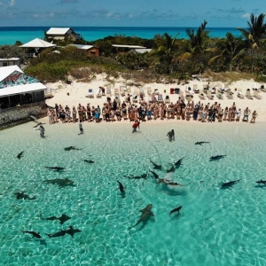
Swimming with Pigs in Nassau, Transportation Included
Sold by J&S Tours & Swimming Pigs