Jeremy Davis #4 // # Understanding the Hurricane Season
Andy Schell sits down with marine meteorologist Jeremy Davis, Director of Operations at Weather Routing Incorporated, to analyze a deeply anomalous Atlantic hurricane season on 59° North Sailing‘s On the Wind podcast. Following the Annapolis Boat Show and offshore skipper events on Chesapeake Bay, the seasonal metrics present a striking contradiction: while the Atlantic Ocean languishes at roughly 10% of its normal cyclonic energy, the Eastern and Central Pacific basins are experiencing record-breaking storm generation.
To decipher this stark disparity for offshore sailors preparing autumn passages south, Davis outlines the global atmospheric circulations at play. A strengthening El Niño event across the Pacific has inverted typical trade wind flows, triggering downstream teleconnections that reshape conditions across the North Atlantic.
Atmospheric Teleconnections: How El Niño Suppresses the Atlantic
Under normal non-El Niño conditions, trade winds blow reliably from east to west across the tropical Pacific south of the equator, driving warm surface water westward toward Indonesia and Australia while allowing colder, nutrient-dense water to upwell along the coast of South America. During an El Niño year, those southern Pacific trade winds weaken or reverse direction entirely. Warmer water that normally pools in the western Pacific either slows down or backtracks, accumulating off Peru and northern South America where sea surface temperature departures reach 5 to 6 degrees Celsius above average.
This massive redistribution of thermal energy alters global atmospheric circulation. In the Eastern Pacific, intense convection and rising air generate an expansive downstream upper-level trough across the tropical Atlantic, the Caribbean Sea, and the Gulf of Mexico. This upper-level feature generates sustained westerly winds aloft running 30 to 50 knots through the mid and upper atmosphere. At the ocean surface across the tropical Atlantic, the trade winds continue blowing out of the east-northeast. This vertical shear in both wind speed and wind direction creates an environment hostile to organized tropical systems.
Davis explains how this vertical shear halts storm formation:
“essentially tropical systems like to have not a lot of high winds aloft that can essentially like decapitate a system and tilt the circulation and rip it apart.”
A clear illustration occurred with Tropical Storm Dolly, which formed west of Africa and tracked westward across the open Atlantic. As Dolly approached the Caribbean, it collided directly with this powerful westerly shear aloft, which shredded its circulation and prevented further intensification into a hurricane. While localized pockets of lighter shear allowed weak tropical storms such as Fay and Hanna to form farther north near Cape Hatteras, the broader Atlantic basin remained locked under hostile winds aloft.
Accumulated Cyclone Energy and Historical Records
To evaluate the true severity of a tropical season beyond raw storm counts, meteorologists utilize the Accumulated Cyclone Energy index. Davis explains that the index calculates the square of a system’s sustained wind speed every 6 hours divided by 10,000, summing those values throughout a storm’s lifecycle. Because the formula is exponential, a weak 40 knot tropical storm adds very little energy, whereas a sustained Category 5 hurricane adds substantial values.
The contrast between the Atlantic and Pacific basins exposes an unprecedented divergence in storm energy:
- The Atlantic Accumulated Cyclone Energy index stands at 9.3 against a climatological normal to date of 91.7, representing approximately 10% of typical seasonal activity.
- The Eastern and Central Pacific Accumulated Cyclone Energy index registers at 254.4 against a climatological normal to date of 110.1, generating 27 times the cyclonic energy of the Atlantic.
- The Atlantic has generated eight tropical storms but zero hurricanes to date, marking the first time in the modern satellite era that began in 1960 that the basin has reached this point on the calendar without a single hurricane.
- Historical records indicate that 1914 was the last time the Atlantic progressed this late into autumn without producing a hurricane.
Davis notes that:
“1914 was the last time so far that we’ve gotten to this date without a without a hurricane in the Atlantic.”
While the Atlantic languished, the Eastern Pacific produced extreme storms, including Category 5 Hurricane Polo, which bottomed out at a central pressure of 892 millibars. Recording the second-lowest surface pressure in Eastern Pacific history and reaching Category 5 status 3 separate times, Polo drove catastrophic flooding across mainland Mexico and delivered heavy tropical moisture into New Mexico, Texas, Colorado, and Arizona.
| Metric | Atlantic Basin | Eastern & Central Pacific Basin | Climatological Context |
|---|---|---|---|
| Current ACE Index | 9.3 | 254.4 | Pacific activity exceeds Atlantic by 27 times |
| Normal Climatological ACE to Date | 91.7 | 110.1 | Atlantic sits at approximately 10% of expected energy |
| Modern Hurricane Deficit Record | 0 hurricanes | Multiple Category 5 systems | First Atlantic season without a hurricane to this date since 1914 |
| Minimum Central Pressure | Weak tropical storms | 892 millibars (Hurricane Polo) | Second-lowest surface pressure recorded in Eastern Pacific |
The Thermodynamics of Cyclogenesis: Tropical Versus Extratropical Storms
Navigating late-season weather patterns requires understanding the fundamental thermodynamic distinctions between storm types. Davis explains that extratropical storms, such as winter nor’easters along the northeastern United States, feed on sharp horizontal temperature contrasts across opposing air masses. These systems feature distinct cold, warm, and occluded frontal boundaries that generate energy from baroclinic instability over broad geographic regions. In September, nor’easters account for only about 1% of annual extratropical storm activity.
Tropical cyclones operate on an entirely different mechanism. They are non-frontal, warm-core systems that depend on uniform temperature and moisture throughout the surrounding air mass. Rather than feeding on air mass contrasts, tropical systems require warm sea surface temperatures of at least 25 to 26 Celsius, abundant atmospheric moisture, and light winds aloft that allow convection to release latent heat energy into the upper troposphere. Systems must generally form north of 10 degrees north latitude so the Coriolis effect provides sufficient rotational force.
Davis notes that stalled frontal boundaries can occasionally trigger tropical cyclogenesis. When a cold front pushes off eastern North America and stalls over the warm waters of the Gulf of Mexico or southeast coast, its horizontal temperature contrast gradually washes out. The lingering cyclonic disturbance left behind can then tap into warm waters and develop into a tropical system, as demonstrated by Tropical Storm Edouard in the Gulf of Mexico. Conversely, tropical storms like Hanna moving northward into cooler waters and stronger upper-level winds eventually ingest contrasting air masses, develop frontal boundaries, and transition into extratropical lows.
Offshore Complacency and Lessons from Hurricane Andrew
For sailors preparing autumn passages south toward the Caribbean or the Bahamas, Davis and Schell emphasize that a quiet season must never encourage complacency. Even in years characterized by low energy and persistent shear, isolated windows of favorable conditions can allow catastrophic outlier storms to develop rapidly.
The benchmark historical precedent remains Hurricane Andrew in August 1992. Andrew emerged during an exceptionally quiet Atlantic season as the first named storm of the entire year, yet exploded into a Category 5 hurricane that devastated Homestead, Florida, before crossing the peninsula and striking Louisiana as a Category 3 storm. Schell recalls driving through Miami and Key West with his family 9 months later, witnessing firsthand an entire coastal region where neighborhoods remained obliterated. Davis, who began tracking storms at age 7 in 1985 on the Weather Channel, tracked Andrew at age 14.
Reflecting on long-term weather patterns, Davis stresses:
“There’s really not two seasons that ever ever look alike. There’s just so much volatility with them.”
This volatility is evident in the Pacific, where Hawaii has faced continuous hurricane threats fed by ocean water running 5 to 6 degrees Celsius above normal. Schell notes the ordeal of offshore sailor Paul Exner, whose boat and residence were destroyed in Tortola during Hurricane Irma; after rebuilding and relocating to Hawaii, Exner found himself dodging consecutive hurricane threats.
Davis highlights how storm impacts linger in the landscape, describing his investigation into forensic forestry at Rhododendron State Park in New Hampshire. Nearly 90 years after the devastating 1938 New England hurricane struck with 100 mph southeasterly winds, living trees in the park remain permanently bent from southeast to northwest, preserving physical evidence of historical hurricane forces.
Reanalyzing 193,000 Offshore Miles with ECMWF ERA5 Climatology
Turning from macro meteorology to passage analysis, Schell shares a custom global voyage mapping tool developed for 59 North. The platform maps all 193,000 nautical miles logged by the fleet since 2015, spanning voyages from 2,900 miles during the company’s inaugural 2015 season up to 31,000 miles sailed across fleet vessels in 2025.
The interactive interface connects via API to the ECMWF ERA5 reanalysis climatology database, which archives hourly global surface weather readings dating back to 1940. By overlaying historical wind barbs, barometric pressure, precipitation, and ocean currents featuring Gulf Stream eddies directly onto vessel tracks, skippers can debrief tactical passage decisions. The map also incorporates an astronomical overlay displaying the geographic positions of the 57 primary navigational stars, such as Arcturus and Jupiter, along with summer solstice solar positions adjusted for Earth’s axial wobble.
Reviewing a June 2019 sub-Arctic voyage aboard Icebear from Lunenburg, Nova Scotia to St. John’s, Newfoundland, Schell and Davis examine the tactical weather data. Icebear departed Lunenburg following a frontal passage that shifted winds to the west, logging sustained 35 knot winds down to St. Pierre on what became the fastest 100 miles the boat had sailed. As Icebear entered the iceberg zone, sea temperatures dropped to 38 degrees Fahrenheit before the crew anchored in a southern Newfoundland fjord to hike and swim in a river under 55 to 60 degree temperatures.
Offshore reanalysis also illuminates fine-scale squalls that global models fail to resolve. Schell examines a 2019 mid-Atlantic passage aboard Isbjørn where a subtle inverted trough barely registered on standard GRIB wind barbs, yet produced extreme localized weather recorded in the boat log:
“Expected showers and squalls today. Instead we got an hour of 60 knots. Hardest rain we’ve ever seen. No visibility. Running down wind. Bare poles at 10 knots. Crew was amazing. Nothing broke.”
Davis points out that interpolated weather archives capture prevailing conditions across 6 hour intervals, but fine-scale features like inverted troughs and convective outflow boundaries slip between grid points. On another passage through the Old Bahama Channel, WRI meteorologists provided real-time warnings to 59 North regarding a 30 knot westerly outflow boundary spreading from collapsing thunderstorms to the west, demonstrating why automated pilot charts must always be paired with active meteorological routing.
Frequently Asked Questions
A developing El Niño in the Pacific weakened equatorial trade winds and caused warm water to pool off South America. The resulting convection and rising air established an upper-level trough across the Atlantic, generating 30 to 50 knots of westerly wind shear aloft that decapitated developing tropical circulations.
The Accumulated Cyclone Energy index squares a tropical system’s sustained wind speed every 6 hours and divides the sum by 10,000. Because the index is exponential, short-lived weak tropical storms add very little, whereas long-duration major hurricanes contribute substantial energy values.
Historical records show that 1914 was the last season the Atlantic progressed this late without a hurricane. It also marks the first time this phenomenon has occurred during the modern satellite meteorology era that began in 1960.
Extratropical storms possess frontal boundaries and feed on horizontal temperature contrasts between opposing air masses. Tropical cyclones are non-frontal, warm-core systems that rely on latent heat release from warm sea surface temperatures of at least 25 to 26 Celsius and low vertical wind shear.
In August 1992, Hurricane Andrew formed during an exceptionally quiet Atlantic season as the first named storm of the entire year. It rapidly intensified into a Category 5 hurricane that devastated Homestead, Florida, proving that low-activity seasons can still produce catastrophic storms.
Andy Schell integrated the ECMWF ERA5 climatology database dating back to 1940 into a custom mapping platform. By layering historical wind barbs, barometric pressure, ocean currents, and celestial coordinates over 193,000 miles of fleet tracks, skippers can examine passage decisions and analyze localized squalls.
Book a trip where this was filmed — near New York City







Support 59° North Sailing
At WeBoating.com, we profoundly acknowledge the unwavering dedication that 59° North Sailing invests in crafting each and every video or voyage. Their passion for delivering exceptional ocean content shines through every frame, and it's a labor of love that deserves your attention.
We invite you to watch their captivating videos here and actively engage with their content, including their social media links above. Liking, commenting, and sharing their work goes a long way in fueling their creative fire.
We're also inviting you to explore the gear, sponsorships, and boat partnerships highlighted in the "Jeremy Davis #4 // # Understanding the Hurricane Season" video description, or directly on YouTube. By engaging with these offerings or purchasing services and items, you directly support 59° North Sailing, their collaborators, and the brands they're associated with.
To ensure you never miss an offshore update, consider visiting their official YouTube Channel to subscribe, like, and join their community directly.
If you have any feedback, corrections, or additional information about 59° North Sailing or their videos, please use the comment form below to share your thoughts with us.
Thank you for being a part of our community and supporting the creators we cherish. Your time and support truly matter!
Atlantic hurricane season has been flipped upside down. While the Atlantic sits at just 10% of its normal cyclone energy, the Eastern and Central Pacific are seeing record-breaking storms. Meteorologist and weather-routing specialist Jeremy Davis explains the atmospheric domino effect behind this unusual split, and what it means for sailors.
--
Support the podcast & become a member of The Quarterdeck, where Andy, August & Mia dive deep on the art of seam'nship. Nerd out with us on our members-only forum and talk boats, gear, safety-at-sea, meet like-minded sailors, find crew, and more. Check it out on quarterdeck.59-north.com. See you there!
--
This season of ON THE WIND is supported by our friends at Weems & Plath and BVI Yacht Sales. Support the show by supporting our sponsors!
59° North Sailing
Global offshore sail training and heavy-weather forensics with SV Falken and SV Isbjørn. Join Andy Schell and Mia Karlsson as they manage a professional multi-boat fleet across the South Pacific and North Sea in 2026.
Channel Information:
Social Media Links:
Jeremy Davis #4 // # Understanding the Hurricane Season Location
- Annapolis, Maryland, USA (38.9784,-76.486)
- Road Town, Tortola, British Virgin Islands (18.4237,-64.6185)
- Lunenburg, Nova Scotia, Canada (44.3768,-64.3188)
- St. John's, Newfoundland, Canada (47.5615,-52.7126)
- Hamilton, Bermuda (32.2949,-64.783)
Latest Episodes from 59° North Sailing
Explore the most recent voyages. Subscribe to the channel to never miss an update!
Zach Dallaire // Sailing Links
Zach Dallaire joins 59° North Sailing's Andy Schell to detail his Sailing Links project, cruising remote coastlines across Atlantic Canada to play world-class golf courses.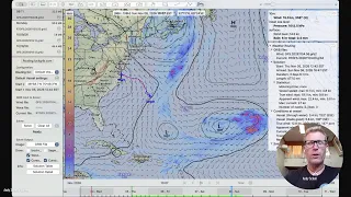
Why the Salty Dawg Rally Should Depart on Saturday Nov. 7 | Real-Time Offshore Weather Briefing
Andy Schell analyzes offshore weather for the Salty Dawg Rally, comparing a Thursday start against waiting for Saturday's post-frontal window across the Gulf Stream.
Pro Meteorologist Explains the Hurricane Season // On The Wind Podcast #509
Meteorologist Jeremy Davis joins Andy Schell to explain the split hurricane season, detailing how Pacific El Niño wind shear suppresses Atlantic storms and analyzing historical passage telemetry.
Jeremy Davis #4 // # Understanding the Hurricane Season
Meteorologist Jeremy Davis joins Andy Schell on 59° North Sailing's On the Wind podcast to dissect an anomalous hurricane season, exploring El Niño wind shear, Accumulated Cyclone Energy disparities, and ECMWF ERA5 reanalysis tools.
Sir Robin Knox-Johnston #2 // Talking Sailing With the OG Himself
59° North visits Gosport to interview Sir Robin Knox-Johnston at Clipper HQ, exploring Suhaili's historic cabin, merchant seamanship, and Golden Globe stories.