Sailing from Albania to Italy 🇮🇹 + Sailing Apps We Can't Live Without!
Clearing customs in Sarandë, Albania, concluded an administrative run for Cladene and Donovan of Sailing Okaliptüs aboard their Fountaine Pajot Helia 44 catamaran, Oka. After restarting their 18-month temporary admission clock outside the EU, the cruising couple prepared to cross over to southern Italy. Rather than rushing out, the skippers compared forecasts to find a workable weather window.
A direct crossing from Sarandë to Santa Maria di Leuca spans approximately 75 nautical miles, requiring roughly 15 hours underway. To avoid arriving in an unfamiliar harbor in the dark, the crew chose a staged passage. Stopping at Othonoi, a Greek island off the northwest coast of Corfu, shortened the second leg by 28 nautical miles and shaved about 5 hours off the open-water transit.
Marine Navigation and Passage Planning Toolkit
Before departing, the crew evaluated their suite of cruising apps. Because single forecasts can mislead, Cladene and Donovan compare ECMWF, GFS, and ICON EU weather models to review wind speed, gusts, swell direction, wave periods, and CAPE indices.
- **Atmospheric Tracking:** PredictWind and the maroon-icon version of Windy provide wind and swell forecasts, while Storm Radar tracks live precipitation across Italy. AccuWeather and Weather & Radar show rain layers, while Lightning Tracker sends strike alerts, prompting the crew to stow smaller electronics in the microwave for protection.
- **Harbor and Anchorage Intelligence:** Navily offers crowd-sourced anchorage reviews, seabed data, and diesel prices. No Foreign Land maps shops, dinghy docks, waste disposal, and boatyards while logging 4 years of voyages. Both apps display boats in the area and support direct messaging.
- **Navigation and Anchor Surveillance:** Savvy Navvy assists passage planning, while Navionics Boating provides backup charts, depths, and navigation markers. AIS monitoring runs through Vessel Finder. At anchor, Oka relies on Anchor Alarm alongside Zora, which the crew has beta tested for 2 years.
- **Vessel Hardware Integration:** Two mast-spreader IMOU cameras record day and night, allowing the crew to inspect the seabed for sand and avoid anchoring over seagrass. Garmin ActiveCaptain mirrors chartplotter data to an iPad in the cabin, while VictronConnect monitors batteries, solar panels, and electrical loads.
Staging Anchorage and Valley Squalls in Othonoi
Reaching the south side of Othonoi, the crew navigated around rocky clusters and inaccurate chart soundings. They circled the bay before anchoring in 4 meters of water with 30 meters of swinging room. Donovan verified their hold:
“We tested all the depths and it looks like we’re okay.”
Swinging at anchor, the crew reviewed winter refits: a helm enclosure with battens and roll-up pockets, mosquito screens, black sunroof covers, new eyebrows, and screen sugar scoop covers keeping their dog Rosie safely aboard.
Although overnight forecasts predicted calm seas and no wind, valley winds suddenly funneled down the island hills into the bay:
“We suddenly had winds of 20 to 25 knots coming down the valley.”
Anchored on a 4-to-1 chain scope about 30 to 40 meters off the breakwater rocks, Cladene spent a sleepless night watching for dragging:
“It wasn’t like the winds were ridiculously high, but it’s just there’s something in your mind that messes with you when you look behind you and there’s a pile of rocks.”
Crossing the Strait of Otranto to Southern Italy
By 6:00 in the morning the valley wind died down, allowing Oka to depart Othonoi at 7:30 AM. With northwesterly winds under 2 knots sailing potential, the crew motor-sailed into the Canal of Otranto against waves with 3 to 4.6 second periods.
Deep water reached 900 meters mid-channel, where nautical charts warned of unexploded explosives. Underway, solar panels replenished batteries, the watermaker topped up tanks, and VHF chatter shifted to Italian. Headwinds developed on the nose with 8 nautical miles remaining.
| Passage Leg | Distance | Duration | Soundings & Conditions |
|---|---|---|---|
| Direct Route (Bypassed) | 75 NM | 15 hours | Avoided to prevent nighttime landfall in Puglia |
| Staging Leg Reduction | 28 NM saved | 5 hours saved | Anchored at Othonoi in 4 m depth with 30 m swinging room |
| Strait of Otranto Crossing | 49 NM | 8 hours | Motor-sailing over 900 m depths with 3 to 4.6 second wave periods |
Landfall in Santa Maria di Leuca and Customs Clearance
Oka docked in Santa Maria di Leuca at 3:30 in the afternoon, logging 49 nautical miles in 8 hours from Othonoi. Situated at the heel of Italy, the harbor is a standard entry port for yachts crossing from Greece.
However, check-in stalled when harbor authorities could not process their transit log because no customs police were present to stamp Donovan’s passport. Cladene described their arrival predicament:
“Well, technically we’re still illegals cuz we couldn’t check in.”
Without passport clearance, the crew remained tied up at the dock awaiting officials to legalize their entry into Italy.
Frequently Asked Questions
The crew compares models across PredictWind, Windy (maroon icon version), Storm Radar for live precipitation in Italy, Lightning Tracker for electrical storms, AccuWeather, and Weather & Radar.
Stopping at Othonoi split the 75-nautical-mile passage from Sarandë to Santa Maria di Leuca into two segments, shortening the final open-water leg by 28 nautical miles so the crossing could be completed in daylight.
Despite forecasts calling for calm water and zero wind, valley winds suddenly accelerated to 20 to 25 knots with gusts reaching 27 knots, testing their 4-to-1 anchor chain scope near a rock breakwater.
Near the maritime boundary between Greece and Italy in the Strait of Otranto, the chart highlighted an unexploded explosives warning zone over 900 meters of water.
The crew could not obtain their Italian transit log because no customs police were present at the port of Santa Maria di Leuca to stamp Donovan’s passport.
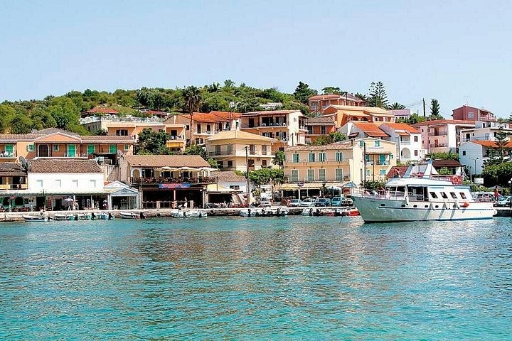
Book a trip where this was filmed — near Corfu
Support Sailing Okaliptüs
At WeBoating.com, we profoundly acknowledge the unwavering dedication that Sailing Okaliptüs invests in crafting each and every video or voyage. Their passion for delivering exceptional ocean content shines through every frame, and it's a labor of love that deserves your attention.
We invite you to watch their captivating videos here and actively engage with their content, including their social media links above. Liking, commenting, and sharing their work goes a long way in fueling their creative fire.
We're also inviting you to explore the gear, sponsorships, and boat partnerships highlighted in the "Sailing from Albania to Italy 🇮🇹 + Sailing Apps We Can't Live Without!" video description, or directly on YouTube. By engaging with these offerings or purchasing services and items, you directly support Sailing Okaliptüs, their collaborators, and the brands they're associated with.
To ensure you never miss an offshore update, consider visiting their official YouTube Channel to subscribe, like, and join their community directly.
If you have any feedback, corrections, or additional information about Sailing Okaliptüs or their videos, please use the comment form below to share your thoughts with us.
Thank you for being a part of our community and supporting the creators we cherish. Your time and support truly matter!
Ep. 230 ~ We're sailing from Sarandë, Albania, to Santa Maria di Leuca, Italy, aboard our catamaran, Oka! But before setting off, we're sharing the sailing apps we rely on for passage planning, weather forecasts, navigation, anchorages and keeping an eye on our boat.
We'll show you the apps we actually use, including PredictWind, Windy, Navily, No Foreign Land, Navionics, Savvy Navvy, Zora and more. From checking wind speed, gusts and swell to finding safe anchorages, tracking boats and monitoring our onboard systems, these apps have become an essential part of our cruising life.
Then it's time to leave Albania, stop overnight at Orthoni, Greece, and make the crossing to southern Italy. Of course, the weather doesn't quite cooperate, and arriving in Italy brings an unexpected paperwork problem!
Join us for another adventure sailing the Mediterranean aboard our Fountaine Pajot Helia 44 catamaran.
If you're interested in sailing, liveaboard life, sailing apps, passage planning, weather routing and cruising the Mediterranean, you're in the right place!
Thanks for watching and fair winds!
Timestamps:
00:00 Intro
01:15 Passage Planning
02:09 Apps we use for sailing
08:02 Our sail plan and weather forecast
08:59 Leaving Sarandë Albania
13:39 Sleepless night in Orthoni Greece
15:48 Leaving Orthoni and sailing across the Gulf of Otranto to Italy
20:57 Arriving to Santa Maria di Leuca Italy
22:22 Outro
Track our real-time and past navigations:
Vessel Finder: www.vesselfinder.com
Marine Traffic: marinetraffic.com
No Foreign Land: www.noforeignland.com
Boat Name: OKALIPTÜS
Boat Type: Pleasure craft
MMSI# : 368289480
Flag: USA
🙌 Follow Us on Social Media:
▶︎ FACEBOOK: Sailing OKALIPTÜS
▶︎ INSTAGRAM: @sailing_okaliptus
▶︎ TWITTER: @SOkaliptus
For this episode, I’ve used my iPhone XS Max, dji Mini 2 drone, GoPro Hero 3, IMOU Bullet 2E, IMOU CruiserSE+ spreader cameras and the robust Fujifilm X-T3 Mirrorless Digital Camera
🔔 Don't forget to SUBSCRIBE to our channel and hit the notification bell so you never miss an update! Give this video a THUMBS UP if you enjoyed it, and share your thoughts in the COMMENTS BELOW. We love hearing from you! Stay tuned for more exciting content coming your way. Thank you for your support! 🎥✨
#Sailing #LivingAboard #Catamaran #LivingAboard #Sailboat #CatamaranSailing #SailingMediterranean #SailingLife #Mediterranean #FountainePajot #Helia #AncientHistory #CatamaranLife #SailingIonian #SailingApps #SailingAlbania #SailingItaly #MediterraneanSailing #LiveaboardLife #SailingGreece #PassagePlanning #Weatherwindow #SailingGreeceItaly

Sailing Okaliptüs
Welcome to Sailing Okaliptüs! Join our sailing adventures on a 13.3m Fountaine Pajot Helia catamaran & Catalina 22, exploring Mediterranean wonders: Turkey, Greece, Albania, Montenegro & Croatia. Discover sailing tips, boat repairs, DIY projects, local cultures and our navigation skills (both the good and the bad). Subscribe for thrilling travel, cruising guides, and life at sea!
Channel Information:
Social Media Links:
Sailing from Albania to Italy 🇮🇹 + Sailing Apps We Can't Live Without! Location
- Sarandë, Albania (39.8715,20.0038)
- Othonoi, Greece (39.841793,19.4064466)
- Santa Maria di Leuca, Italy (39.7997,18.3583)
Latest Episodes from Sailing Okaliptüs
Explore the most recent voyages. Subscribe to the channel to never miss an update!
Sailing from Albania to Italy 🇮🇹 + Sailing Apps We Can’t Live Without!
Cladene and Donovan sail their catamaran from Sarandë, Albania, to Santa Maria di Leuca, Italy, evaluating crucial marine weather apps and managing an unexpected overnight squall in Othonoi along the Strait of Otranto.
Sailing The Med | Bureaucracy + Marriage = Potential Alcoholism 🇬🇷⛵🇦🇱
Clearing out of Corfu to reset their 18-month EU yacht admission clock, Cladine and Donovan refuel at Gouvia Marina before crossing to Sarandë, Albania, navigating deep anchorages and busy waterfront evenings aboard their catamaran Okaliptüs.
Corfu’s Beautiful Streets, a Surprise Reunion & a Splash of Drama
After plumbing repairs in Preveza, Donovan and Claudine sail Oka into Corfu, anchoring in sand near the Old Fortress, braving a squall, and navigating the Venetian Contrafossa canal.
Sailing the Med, One Boat Job at a Time | Paxos Greece
In Preveza, Donovan and Claudine replace their water pump and accumulator before navigating rolling swells to Paxos, tackling tricky anchoring at Kipiyadi Bay.
The Reality of Living on a Sailboat | Leaving Greece
Clodagh and Donovan weather gusty storms in Vonitsa and Preveza aboard catamaran Okaliptüs while managing locker rust, new canvas tracks, and EU VAT rules.