Weather Routing for Offshore Sailors (PredictWind Masterclass 2/5)
The map is not the territory—and a "pretty wind map" is not a passage plan. In this second installment of our 5-part intensive series, we’re diving into the engine room of weather forecasting. After 85,000 miles at sea, I’ve seen how easy it is to trust a colorful screen and sail straight into a disaster. This video is about moving from "looking" at the weather to interpreting it like a professional.
We break down where the data actually comes from, why different weather models often disagree, and how to use "Validation" to decide which forecast is worth betting your life on.
📘 GET THE BOOK & SAVE $100
My book "Be The Captain" is the foundation of this entire series. It pays for itself because every reader gets 20% OFF a PredictWind Standard or Pro subscription (up to a $100 savings).
👉 Grab your copy and the discount here: https://bethecaptain.com/
⚓️ WHAT YOU WILL LEARN IN VIDEO #2:
We are taking the setup from Video #1 and putting it to work. In this session, we cover:
The Anatomy of a Forecast: From weather buoys and satellites to GRIB (Gridded Binary) files.
The Models Explained: Understanding the "personalities" of ECMWF, GFS, UKMO, ICON, and the AI-driven AIFS.
PredictWind Proprietary Models: Why PWG, PWE, and PWAI provide the high-resolution edge you need.
The Validation Tool: How to check which model has been the most accurate in your specific area over the last 24 hours.
GMDSS Integration: Why you must never ignore official international maritime safety warnings, even if the routing looks clear.
The "USS San Francisco" Rule: Why zooming in and setting exclusion zones (Boundaries) is the difference between a successful passage and hitting an underwater mountain.
⚖️ TECHNICAL DISCLOSURE & TRANSPARENCY
To make this series possible, PredictWind provided the iPad and the professional editing used in these videos, along with my Pro account. However, I have received no cash payment for this series. I retain 100% editorial control. My goal is to get you the best training—and the best price—on the tools I trust with my own life.
📽️ THE PREDICTWIND MASTERCLASS SERIES:
Video 1: The Foundation & Setup
https://youtu.be/JTJTCXnd8e0
Video 2: Weather Routing & Interpretation (You are here)
https://youtu.be/S1DvOBNulFU
Video 3: Power Routing for Comfort
https://youtu.be/QTrIFfbL6VY
Video 4: Safety, AIS & Extra Features
https://youtu.be/C5zBfqqwDMM
Video 5: The Offshore App & Starlink Integration
Video Chapters
00:00 Weather Routing vs. Pretty Maps
00:40 Where Weather Data Comes From
01:07 What are GRIB Files?
01:39 Evolution of Sailing Weather Tools
02:53 GFS vs. ECMWF: Weather Models Explained
03:30 AI and PredictWind Proprietary Models
04:22 How to Use Forecast Validation
04:51 Step-by-Step Routing Setup
05:50 Why Graphs are Better Than Maps
06:30 Comparing Routes in the Summary Table
07:01 Vertical Acceleration & Crew Comfort
07:24 Navigation Safety & Exclusion Zones
08:32 GMDSS: Official Maritime Safety Warnings
09:55 Rerunning Weather Routes Offshore
10:11 Risk, Comfort, and Seamanship
#Sailing #PredictWind #WeatherModels #OffshoreSailing #BeTheCaptain #GRIB #GMDSS #SailingZingaro #Seamanship #WeatherForecasting

Sailing Zingaro
Join James Evenson of Sailing Zingaro as he documents his 2026 technical refit of his Crowther Spindrift 38 in Colombia and his 'Sailing Truth' mission.
Channel Information:
Social Media Links:
Support Sailing Zingaro
At WeBoating.com, we profoundly acknowledge the unwavering dedication that Sailing Zingaro invests in crafting each and every video or voyage. Their passion for delivering exceptional ocean content shines through every frame, and it's a labor of love that deserves your attention.
We invite you to watch their captivating videos here and actively engage with their content, including their social media links above. Liking, commenting, and sharing their work goes a long way in fueling their creative fire.
We're also inviting you to explore the gear, sponsorships, and boat partnerships highlighted in the "Weather Routing for Offshore Sailors (PredictWind Masterclass 2/5)" video description, or directly on YouTube. By engaging with these offerings or purchasing services and items, you directly support Sailing Zingaro, their collaborators, and the brands they're associated with.
To ensure you never miss an offshore update, consider visiting their official YouTube Channel to subscribe, like, and join their community directly.
If you have any feedback, corrections, or additional information about Sailing Zingaro or their videos, please use the comment form below to share your thoughts with us.
Thank you for being a part of our community and supporting the creators we cherish. Your time and support truly matter!
The map is not the territory—and a “pretty wind map” is not a passage plan. In this second installment of our 5-part intensive series, we’re diving into the engine room of weather forecasting. After 85,000 miles at sea, I’ve seen how easy it is to trust a colorful screen and sail straight into a disaster. This video is about moving from “looking” at the weather to interpreting it like a professional.
We break down where the data actually comes from, why different weather models often disagree, and how to use “Validation” to decide which forecast is worth betting your life on.
📘 GET THE BOOK & SAVE $100
My book “Be The Captain” is the foundation of this entire series. It pays for itself because every reader gets 20% OFF a PredictWind Standard or Pro subscription (up to a $100 savings).
👉 Grab your copy and the discount here: https://bethecaptain.com/
⚓️ WHAT YOU WILL LEARN IN VIDEO #2:
We are taking the setup from Video #1 and putting it to work. In this session, we cover:
The Anatomy of a Forecast: From weather buoys and satellites to GRIB (Gridded Binary) files.
The Models Explained: Understanding the “personalities” of ECMWF, GFS, UKMO, ICON, and the AI-driven AIFS.
PredictWind Proprietary Models: Why PWG, PWE, and PWAI provide the high-resolution edge you need.
The Validation Tool: How to check which model has been the most accurate in your specific area over the last 24 hours.
GMDSS Integration: Why you must never ignore official international maritime safety warnings, even if the routing looks clear.
The “USS San Francisco” Rule: Why zooming in and setting exclusion zones (Boundaries) is the difference between a successful passage and hitting an underwater mountain.
⚖️ TECHNICAL DISCLOSURE & TRANSPARENCY
To make this series possible, PredictWind provided the iPad and the professional editing used in these videos, along with my Pro account. However, I have received no cash payment for this series. I retain 100% editorial control. My goal is to get you the best training—and the best price—on the tools I trust with my own life.
📽️ THE PREDICTWIND MASTERCLASS SERIES:
Video 1: The Foundation & Setup
Video 2: Weather Routing & Interpretation (You are here)
Video 3: Power Routing for Comfort
Video 4: Safety, AIS & Extra Features
Video 5: The Offshore App & Starlink Integration
Video Chapters
00:00 Weather Routing vs. Pretty Maps
00:40 Where Weather Data Comes From
01:07 What are GRIB Files?
01:39 Evolution of Sailing Weather Tools
02:53 GFS vs. ECMWF: Weather Models Explained
03:30 AI and PredictWind Proprietary Models
04:22 How to Use Forecast Validation
04:51 Step-by-Step Routing Setup
05:50 Why Graphs are Better Than Maps
06:30 Comparing Routes in the Summary Table
07:01 Vertical Acceleration & Crew Comfort
07:24 Navigation Safety & Exclusion Zones
08:32 GMDSS: Official Maritime Safety Warnings
09:55 Rerunning Weather Routes Offshore
10:11 Risk, Comfort, and Seamanship
#Sailing #PredictWind #WeatherModels #OffshoreSailing #BeTheCaptain #GRIB #GMDSS #SailingZingaro #Seamanship #WeatherForecasting
Latest Episodes from Sailing Zingaro
Explore the most recent voyages. Subscribe to the channel to never miss an update!
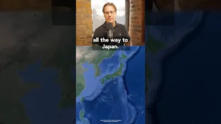
Routing Through Typhoons in the South Pacific
Pacific passage planning considers tropical storm rotation, latitude, and the doldrums. And depending on the time of year, the shifting Intertropical Convergence Zone really comes into play. Full Stream: 📗 Get My Book:
This Pacific Passage is a Bad Idea
A proposed November passage from Langkawi to Oahu raises questions about storm timing, fuel range, and sailing against the trade winds. I propose an alternative route and get into challenge of approaching Hawaii from near the equator. Full Stream: 📗 Get My Book: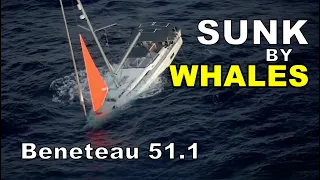
You Asked About the Beneteau 51.1. At That Exact Moment, One Was Sinking | LIVE
Last Saturday, someone on this livestream asked me whether a Beneteau Oceanis 51.1 could handle bluewater cruising. At almost the SAME TIME (Saturday, Sep 26th), a 51.1 was sinking in the South Pacific after a run-in with sperm whales. Both sailors got off safely and the Royal New Zealand Air Force ...
Life Rafts Can Only Get You So Far…
A passing ship can miss a life raft completely. Flares, an EPIRB, a prepared ditch bag, and a crew who knows where the equipment is all belong in the conversation before an emergency happens. Full Stream: 📗 Get My Book:
This Could Save Your Life Offshore
A solar still uses the sun’s heat to evaporate seawater and collect fresh water as it condenses, leaving the salt behind. Here’s the basic principle behind this compact piece of offshore survival equipment. Full Stream: 📗 Get My Book: Be the Captain YT: